- Vladimir Daigele
Advanced
Event Organizer(s)
Description
Broadband mapping combined with modern Geographic Information Systems (GIS) and its practical knowledge supports efficient identification of connectivity gaps, network planning to extend access to most critical places, and support to decision making based on data-based models. Developed by the ITU, this training offers an advanced path to continue the introductory course of Broadband Mapping, provided also in a Self-paced format by the ITU Academy. The course consists of 3 modules: Data Standardization and Data Storage; Geospatial ICT Infrastructure Analysis; and the Open Fiber Data Standard.
The advanced broadband mapping training is designed to participants willing to advance their knowledge on geospatial practical tools applied to telecommunications/ICT networks development.
It is recommended for participants to successfully complete the Introduction to broadband mapping course’s modules, also available free of charge through the ITU Academy platform.
This course is for participants to delve into the advanced elements of broadband mapping.
In the first part of this course participants will learn about data standardization's importance for development work on ICT infrastructure analysis and the practical use of data dictionaries to achieve the goal of expanding access to underserved or unconnected communities. This part course will cover essential topics such as databases and database management systems, with a specific focus on mastering practical examples.
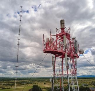
The second part of this course aims to explain and demonstrate the use of geospatial analysis using ICT infrastructure data and related data for solving connectivity barriers hampering access to digital technologies to localities, public building, refugee camps and any other points of interest when connectivity analysis is needed. Three basic practical tools developed by ITU will be presented: 1-Estimating population density; 2-Radio-visibility to a telecommunication tower;
Upon completion of this course, participants will be able to:
- critically analyse the intricate elements of using geospatial tools for broadband mapping used for decision-making, demonstrating an ability to distinguish between various components and their functions.
- use data dictionaries effectively to ensure consistency and accuracy in broadband mapping projects.
- conduct initial geospatial analyses using tools developed by ITU addressing connectivity barriers.
- Examine the practical use of the Open Fibre Data Standard.
The course is delivered using the ITU Academy Learning Management System, with interactive activities like quizzes, drag and drop exercises, flip cards, and other interactive tools aiming to improve the learning experience.
Final quiz (100%)
Total score higher than 70% is required to obtain the ITU digital badge.
Module 1: Standardization and Data Dictionaries
- Introduction
- Databases and Database Management Systems
- Geospatial Databases: PostgreSQL and PostGIS
- Case studies: Data dictionaries for development work on geospatial connectivity analysis
Module 2: Geospatial Analysis for ICT
- Introduction
- Mapping of the population density around the connectivity target;
- Visibility of the location (building, squares, etc.) to telecommunication towers
- Estimation of the Fiber Optic Cable Communication Path
- Additional resources on geospatial analysis for ICT infrastructure studies
Module 3: Open Fibre Data Standard (OFDS)
- Introduction
- Current practice and regional reflections
- Open standards for data
- The Open Fibre Data Standard
- Implementing OFDS
Final quiz