- Alex Högback
Introductory
Event Organizer(s)
Initiative
Description
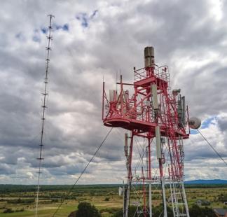
This course introduces the methodology for measuring gaps in ICT infrastructure and carrying out connectivity business planning in order to connect schools to the Internet. It covers topics such as working with geospatial data, getting open data on ICT infrastructure, standardizing data for GIS analysis, connectivity demand estimation, visibility analysis for radio links, and fiber path modeling.
At the end of the course, participants will be able to collect ICT infrastructure data, identify underserved areas, apply GIS tools, and use connectivity models to test and compare selected connectivity scenarios for schools.
Data analysts, telecommunications professionals or policymakers with an interest in infrastructure mapping for connectivity projects.
This course is open to all.
Upon completion of this course, participants will be able to:
- Source vector and raster geospatial data for connectivity analysis (infrastructure locations, terrain and quality of service)
- Process and manage geospatial data within open-source GIS environments.
- Analyze the demand for connectivity using population datasets.
- Assess the feasibility of various technologies (fibre, point-to-point and point-to-area) for different locations.
- Estimate deployment costs based on geospatial analysis.
- Assess the commercial viability of an ICT infrastructure project with business planning tools.
The training will take an interactive approach to introduce core concepts and key tools for infrastructure mapping, along with case study analysis and real-life examples. To reinforce learning, the course will include quizzes and assessments to track progress and exercises and case studies to apply the course learning.
The assessment will be done using quizzes and problem-solving exercises at the end of each module. A total score of 80% or higher is required to obtain the ITU digital badge.
Module 1 - Introduction to course and a brief overview of Giga
- Understand the Giga initiative for connecting schools to the Internet
- Explain how geospatial data influences decision-making in network optimization and expansion projects
Module 2 - Working with geospatial data
- Differentiate between vector and raster data formats and identify appropriate use cases for each
- Explain the fundamental components of geographic coordinate systems and datum references
- Select appropriate map projections based on specific analytical requirements
Module 3 - Getting open data on ICT infrastructure
- Locate and evaluate open data sources relevant to ICT infrastructure planning
- Source and download open data on ICT infrastructure using API keys
Module 4 - Standardizing data for GIS analysis
- Explain the role of data dictionaries in standardizing geospatial information
- Apply ITU data dictionary specifications to structure ICT infrastructure datasets
- Know where to find SQL codes to standardize open data sources according to ITU conventions
Module 5 - Connectivity demand estimation
- Extract and interpret population data from WorldPop raster datasets for school connectivity planning
- Calculate zonal statistics to quantify population distribution around educational facilities
- Convert demographic data into throughput requirements (Mbps) using standardized formulas
Module 6 - Visibility analysis for radio links
- Extract topographical data from NASA/SRTM sources to assess line-of-sight visibility
- Assess the feasibility of radio link installations using elevation profiles and terrain models
Module 7 - Fiber path modelling
- Define networks and graphs in the context of telecommunications infrastructure planning
- Implement Dijkstra's algorithm to calculate optimal fiber paths between schools and existing nodes
- Estimate CAPEX requirements for fiber network investments based on optimized path modeling